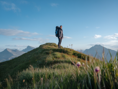
Fog on the Pennine Way is a humbling thing. I’ve walked sections of it when visibility dropped to a few metres and the world collapsed into soft grey. In those moments GPS can feel like a miracle, but batteries fail, devices glitch, and relying solely on a smartphone or watch is a risk I don’t take. Over the years I’ve learned to trust a map, a compass and a few deliberate habits. Below I share how I navigate fog on the Pennine Way without GPS—practical, tested techniques that work in UK uplands and that you can practice before you need them.
Know the route before you set out
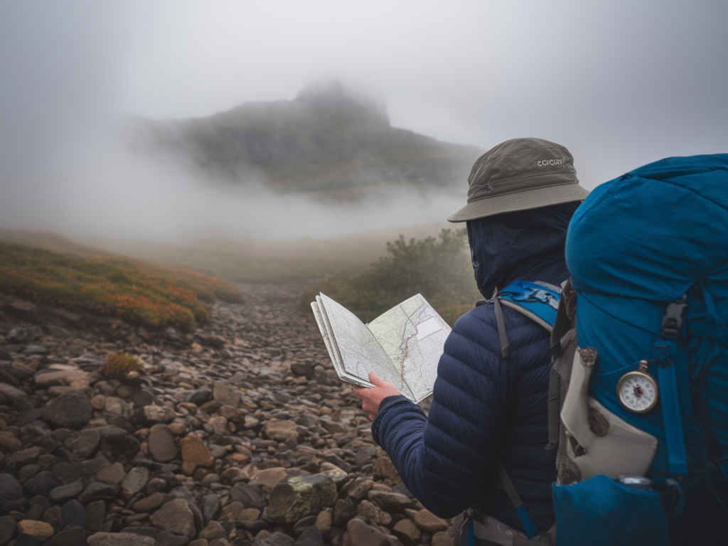
Preparation is everything. Before I step onto the moor, I study the map closely—usually an Ordnance Survey Explorer or OL/OL1 equivalent for the Pennine Way—and note key features: fence lines, cairns, streams, cols, and distinctive contour patterns. I also check route descriptions and guidebooks so I have an idea of what to expect between obvious features. I mark turning points and likely bailout options on my map and in my head.
When planning, I think in chunks of legible navigation: a clear start point, an expected intermediate feature, and a visible destination. In fog that becomes crucial—if one of those chunks is ambiguous, I either delay or pick an alternative with clearer navigational cues.
Essential kit I carry
I always carry physical tools I can rely on in poor visibility. My kit is minimalist but redundant:
Here’s a quick table of items and why I bring them:
| Item | Purpose |
| Paper map | Primary reference; batteries not required |
| Liquid compass | Hold bearings; quick reference for direction |
| Notebook & pencil | Record bearings, times and checkpoints |
| Headtorch | Illumination and signaling |
Basics of map reading in low visibility
Fog robs you of distant visual cues, so I rely heavily on contours and features you can verify close up: streams, bog edges, fence junctions, distinct hummocks and ridgelines. When reading the map I orient it to the terrain—turn the map so north on the map roughly points to north on the ground—and then identify the smallest set of features I can confirm on the ground.
Contours are your friend. Rather than trying to match a distant skyline, look for the shape underfoot: a steep pull of contour lines means a slope or crag; spaced lines mean flatter ground. If the map shows a distinct contour shape—say, a bowl or a re-entrant—plan to use it as a navigation anchor you can feel as you walk.
Using a compass: taking and following a bearing
One of the simplest, most reliable techniques is taking a bearing from a known point to a known point. Here’s how I do it:
In fog I break long bearings into shorter legs—50 to 200 metres at a time—so I can verify features repeatedly. This reduces cumulative error. I also use back bearings: after walking to a point, I take a bearing back to the start to check I’m still on the correct line; if the back bearing is significantly different I know I’ve drifted.
Pace counting and timing
When you can’t see landmarks far ahead, pace counting and timing are essential to estimate distance. On moorland my stride on boggy ground is shorter than on a dry path; I practice counting my paces on different surfaces so my internal odometer is reasonably accurate. I also use time as a secondary measure: know your walking speed on similar terrain and factor in fatigue, wind and boggy ground.
A simple method I use: on a firm path I might count 60 paces per 100 metres; on heather or bog I count more paces. Record these in your notebook and adjust as you go. If a bearing says the next fence junction is 400 metres away, split it into four 100m sections and re-check the compass and map at each interval.
Using contours and linear features
Linear features like fences, drystone walls and streams are invaluable in fog. If you can pick up a fence line, follow it in the correct direction—walls usually run along ridges and in valleys, so map interpretation is critical to ensure you follow the right side. When following a stream, be mindful that it may split or disappear in peat hags; always cross-check with the map for upstream/downstream context.
Contours allow for 'contour-steering': if your line takes you along a particular contour band, aim to maintain a consistent elevation by feeling the slope underfoot. Small fell-side terraces or a change in gradient can be confirmed by keeping an eye on the map and using your compass to hold a direction across the contour.
Dealing with drift and whiteout
Inevitably you’ll drift—wind pushing you, soft ground slowing one foot more than the other, fatigue. To minimise drift I do the following:
On exposed sections of the Pennine Way where paths approach crags or steep drops, I give myself a buffer: plan to knock off route early and drop to a safer area to re-route if visibility collapses. Safety over speed.
Making safe decisions and having bailouts
Confidence in your navigation comes with conservative choices. If I’m unsure about the next stage in fog I slow down, take bearings more often, and if necessary divert to a lower, easier-to-navigate path or a known refuge. Bailout options—bothies, minor roads, villages—should be noted before setting out.
Always communicate your plan to someone: where you’ll be and what time you expect to reach a checkpoint. If conditions worsen and you can’t safely navigate, staying put and using your whistle, torch and thermal blanket can be lifesaving while you wait for visibility to recover or for help.
Practice makes permanent
I practice these skills in any weather I can. A foggy morning on a local ridge is an excellent classroom. Start with short bearings and small, identifiable features before building up to longer legs and complex contour navigation. Practising till the techniques become second nature means you can think calmly and perform effectively when the grey closes in on the Pennine Way.