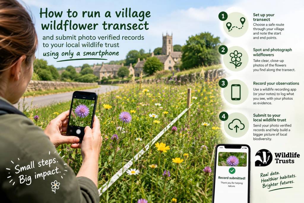
I run village wildflower transects with nothing more than a smartphone, a pair of sensible shoes and a curiosity for plants. Over the years I’ve turned these short, repeatable routes into a practical way to monitor local biodiversity, contribute useful records to my local Wildlife Trust, and involve neighbours in simple conservation. If you want to do the same, here's how I plan, record and submit photo-verified wildflower records using only a phone — no specialist kit required.
Why a village transect?
A transect is simply a fixed path where you make repeated observations over time. For wildflowers, a well-executed transect gives you a snapshot of phenology (who’s flowering and when), presence/absence data for species of conservation concern, and a steady stream of records that local conservation groups can use. It’s low-cost, repeatable and ideal for engaging people who live near the route.
Planning the route
Start with a short walk you can repeat every week or fortnight during the growing season. I use a 1–2 km loop through the village and adjacent green spaces — churchyard grassland, roadside verges, community green, and an allotment edge. Choose places that are safe, publicly accessible, and likely to host a variety of species.
Before you set foot, check ownership and permissions. For council-managed verges and public paths you usually don’t need a permit, but private landowners and churchyards deserve a polite ask. When I begin a new transect I explain the project, how records help the Wildlife Trust, and that I’ll only take photos and leave no trace.
When to walk
I aim for a consistent time of day — mid-morning is good because lighting is forgiving and flowers are often open. Walk weekly through spring and summer, then reduce frequency to fortnightly in autumn. Good weather makes identification easier, but don’t let a drizzle stop you; lots of species are still identifiable when damp.
What I take (smartphone essentials)
- Smartphone with a decent camera and GPS. Modern phones are more than capable — I use mine for photos, location stamping and uploads.
- Power bank if you expect long sessions or cold weather, which drains batteries faster.
- Hand lens app or physical loupe (optional) — fine for seeing small details like hairs or flower structure.
- Notebook app or paper notebook for quick notes (e.g. abundance, habitat, behaviour).
Apps and tools I use
| Purpose | App/Tool | Why I use it |
|---|---|---|
| Identification & community verification | iNaturalist / ObsIdentify | Fast AI suggestions and crowd validation — great for tricky IDs |
| Local record submission | iRecord / Wildlife Trust web forms | Accepted by many local Wildlife Trusts; connects to national recording schemes |
| Plant-specific ID | PlantNet / Flora Incognita | Useful for confirming leaf/flower shape; good second opinion |
| Route & GPS | Google Maps / Gaia GPS | Mark start/finish, measure transect length, check public rights of way |
How I photograph plants for verification
Good photos are the backbone of photo-verified records. I aim for several images per plant to capture the details needed for reliable ID:
- A clear image of the whole plant in its habitat — this shows size, growth form and associates.
- A close-up of the flower from multiple angles (front, side, and detail of petals/stamens if possible).
- Leaf details — arrangement (opposite/alternate), shape, margin and any hairs or glands.
- Fruits or seedheads when present — they’re often diagnostic later in the season.
- A shot including a familiar object (finger, coin) for scale if the plant is very small.
I try to keep the camera steady and let the phone focus — tapping the screen to lock focus/exposure helps. If light is poor, I use a short burst of images and pick the sharpest one later.
Recording metadata
Most apps embed GPS, date and time automatically, which is vital. I always double-check the location pin before uploading — phones can occasionally misplace a point by tens of metres. If a plant is tucked away (churchyard bed or verge) I use the map view to drag the marker to the exact spot.
I also add short notes: abundance (single, scattered, frequent), habitat (roadside verge, managed lawn, hedgerow), and any relevant management actions I noticed (cuttings, herbicide signs). These contextual details make records more useful to ecologists.
Making IDs and verifying records
I often let iNaturalist or ObsIdentify suggest IDs, then confirm with PlantNet or my own field experience. When I’m confident, I submit with that ID. For uncertain cases I upload as a genus or “sp.” and add the best photos for others to help. On iNaturalist, peers and experts will propose IDs and eventually your observation becomes “Research Grade”, which many Wildlife Trusts accept.
Submitting to your local Wildlife Trust
Most Wildlife Trusts accept records through iRecord (BSBI compatible) or via forms on their website. Here’s the flow I use:
- Upload observations to iNaturalist or iRecord. Include photos and precise location.
- If using iNaturalist, export or share records to iRecord where possible, or contact your Trust to confirm they accept iNaturalist exports.
- For species of conservation concern or rare finds, I email the local Biological Records Centre or Wildlife Trust with images, location and date — they appreciate a direct heads-up.
Check your local Trust’s recording guidance — some have bespoke smartphone forms or prefer CSVs from iRecord. I linked each of my transect’s most valuable weekly records to the Trust’s online portal when they requested them for a local monitoring project.
Quality control and ethics
Keep disturbance low. I don’t pick plants except when absolutely necessary and only with permission for small voucher specimens. I avoid tramping sensitive areas and respect closed signs. For sensitive rarities I’ll avoid publicising precise locations until land managers advise.
Be honest about IDs: it’s better to submit a cautious genus-level record with great photos than a confident misidentification. The community will often help refine the record.
Using the data
My records have helped the local Trust track the spread of species like common knapweed and native orchids in nearby meadows. I use them to write short notes on Outdoorangus Co (https://www.outdoorangus.co.uk) and to encourage local volunteers to protect verges that host important wildflowers. Even small datasets can highlight trends: earlier flowering times, species declines in managed verges, or new arrivals after road verge restoration.
Getting others involved
Transects are a fantastic community tool. I’ll sometimes run a short workshop — showing neighbours how to photograph diagnostic features, which apps to use, and how to submit records. People enjoy seeing their names attached to records and knowing they’re helping local conservation. A village transect is both data collection and a way to build stewardship.
If you’d like, I can share a simple transect checklist you can screenshot to your phone before your first walk — it’s the same one I use whenever I head out. Small, regular actions add up: regular transects provide evidence that helps trusts and councils make better decisions for our wild places.